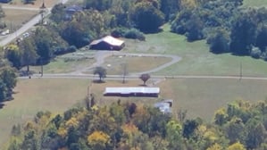
-1.png?width=220&height=220&name=Rock%20Bottom%20Horse%20Camp%20(4)-1.png "Rock Bottom Campground and Stables")
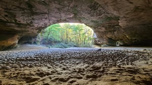
The ride to the Sand Cave is approximately 7.5 miles out and back from camp. Ride to the top of the mountain to reach Ridge Trail and turn east to the Sand Cave (.2 miles). When you reach the hitching posts at the top of the mountain, there is a quarter mile hike to the Sand Cave.
Sand Cave, a natural scenic area in Kentucky, is a half-domed chamber, 250 feet across in front (open). The floor slopes from back to front and is 1.25 acres of fine, colorful sand.
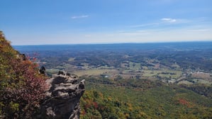
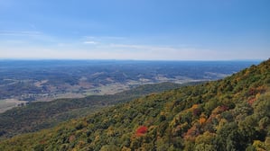
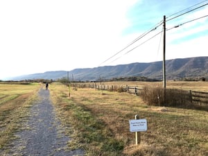
The ride to the White Rocks is approximately 10 miles out and back from camp. It is best done at the same time as the Sand Cave as you pass by it on the way. Ride to the top of the mountain to reach Ridge Trail, then turn east to the White Rock Overlook (1.3 miles). When you reach the hitching posts at the overlook, there is a short hike and small climb up the trail to the breathtaking view. If you look south, you can see Rock Bottom Horse Camp!
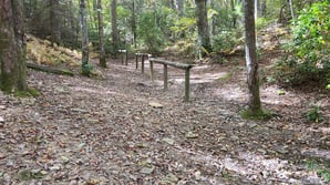
The ride to Hensley Settlement is approximately 16 miles out and back from camp. Ride to the top of the mountain to reach Ridge Trail, then turn west to Hensley Settlement (4.4 miles). Use the hitching posts to tie up your horses while you explore.
DO NOT RIDE IN THE SETTLEMENT!
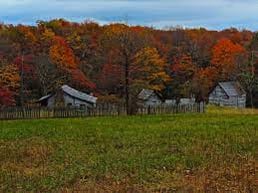
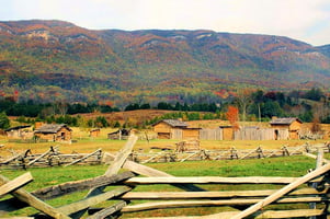
Hensley Settlement is an Appalachian living history museum on Brush Mountain in Kentucky. The settlement contains twelve homestead log cabins, a one-room school house, and a blacksmith shop. A restored spring house on the property was used by the settlement as food storage. The settlement began in 1903 when brothers-in-law Sherman Hensley and Willy Gibbons settled their families on plots from acreage purchased by Barton Hensely, Sr. Most inhabitants belonged to either the Hensley or Gibbons families. The settlement never developed modern infrastructure or technology.
The last resident was Sherman Hensley, who left in 1951. The school, together with some forty-five settlement structures and the agricultural environment, were restored to their original state in the 1960s by the Job Corps.
MUST TRAILER FROM CAMP
This trail is park of the Wilderness Road State Park and starts at the Park and Ride in From of Lincoln Memorial University's DeBusk Veterinary Teaching Center on Hwy 58 and run 9 miles to the parking area near the National Park campground. This trail is a Rails to Trails joint use trail for pedestrians, bicyclists and equestrian riders.
At 2 miles in, the Wilderness Road State Park is a must see destination. Wilderness Road offers picnicking, hiking, and nature and living history programs. Visitors can enjoy the visitor center, home to a theater showing an award-winning docudrama, "Wilderness Road, Spirit of a Nation." The center also has a frontier museum and a gift shop with unique regional gifts. The park features the reconstructed Martin's Station, an outdoor living history museum depicting life on Virginia's 1775 frontier.
(The 2 mile section from mile 6.5 to the National Park is unmaintained 🤕)
The Cumberland Gap National Historical Park has 70+ miles of backcountry riding trails accessible from multiple parking areas. Here are a few suggested rides:
This is a work in progress.....
ALL REQUIRE TRAILERING FROM CAMP
Sugar Run to Rock Bottom Horse Camp -
Wilderness Road Campground parking to Rock Bottom Horse Camp -
Shillalah Creek to Hensley Settlement

For offline maps
(no cell signal)


For offline maps
(no cell signal)


For dynamic maps
